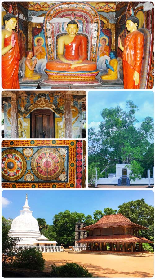
Devagiri Rajamaha Viharaya - Bingiriya
It is clear that the area where the Bingiriya Dewagiri Raja Maha Vihara is Located was Formerly Known as Dakkhina desha.
According to the Present practice of sathkorala it is situated in Bingiriya garamasewa division of the Bingiriya divisional secretariat in Kiniyama korale in Katugampola hathpaththuwa in Kurunegala district of the North Western Province.
According to the division that existed in this plan it is named as Yagampaththu Koralaya of the Devamadi Hathpaththuwa. Other Plan carried out during this period have reserved and area of land along the boundries of Kolamunu oya and Deduru Oya.
According to the divisional that existed in this plan, it is named as Yagampaththu Koralaya of the Devmadi Hathpaththu.
Other plan carried out during this period have reserved and area of land along the boundaries of Kolamunu Oya and Deduru oya.
It is evident that the temple is under the protection of the reserve and up to the middle of the canals.
Boundaries of the temple premises are as follow,
- From the direction of North and North East to Kolamunu Oya.
- From the direction of North Western to Daduru Oya.
- From the direction of south West
Rathna area of Godawela village (at present L.D.O Paddy Field)
From the direction of south West and West to vilaththwa Village (At present it is called Godallayaya Village)
The plan depicts the end of the boundary of the Great tank built by King Agbo I st to the South and the boundary of the Bingiriya canal attached to it. According to the Mukawasi Pamphets king Agbo I st had unloaded 200 anicuts in the Ihalapattiyawala and Pahala Pattiyawela and recruited a large tank to water it.
Accordingly, the area with small ponds and other tanks between the two major sources of water is very clear for the evidence of the land as a prosperous area of Agriculture.
Elevated plan near the vihara area is one of the few high lying areas in the inner plan of the country ending at the Chilaw sea, about 11 miles west of Bingiriya.
Although there is no definitive grounding evidence that a land route had fallen to the ancient kingdom of Anuradhapura and the country in the vicinity of the land. It is undoubtedly close to the area.


